Ergolz Valley

Site intro
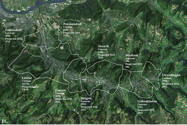
The Ergolz river is an affluent of the Rhine which is 28km long and the main river of the canton of Baselland. It rises in the Tavular Jura hills at the Geissflue and flows into the Rhein at the city of Augst. Ruins of an aqueduct above Liestal are proof that the Ergolz has acted as drinking water supply for the roman city of Augusta Raurica. The Ergolz valley is very narrow and its steep hills are typical for the adjacent hilly landscapes of the tavular Jura with the Gempenplateau in the west and the Arisdorf plateau on the east. The section of this territory is representative of the rapid urbanization and industrialization processes that took place in the last century in Switzerland and that continue to transform a territory famous for its landscape and natural resources. As the settlement area in Switzerland has doubled since 1950, it is clear that the landscape of the Ergolztal is strongly affected by urban sprawl and rising urbanization. The choice of focusing on this specific river valley follows our previous interest in the urbanized side valleys of the Rhine(e.g. Birs valley, Wiese valley). As the small Basel City canton has nearly no land reserves to accommodate any further growth, the river valleys around Basel play an important role in the future development of the metropolitan region. A row of small towns along the Ergolz river (Frenkendorf/ Füllinsdorf, Liestal, Lausen, Sissach, Gelterkinden), with the principal town of canton Baselland Liestal at its center, are all reachable by train from Basel city within approximately 15minutes.
After the industrialization of the mostly rural valley in the late 19th century (silk factories, silk weaving), the population has moderately grown. Since the 1960ies the settlements have grown in a rather disordered and incoherent way following the course of the rivers, motorways and railways. At the moment, a population of about 62’000 inhabitants live in the Ergolz valley. The canton Baselland is expecting a population increase of about 10% until 2040, which ideally should be placed in the lower Hochrhein valley or in the northern Ergolz valley. To accommodate this forecasted population growth in the Ergolz valley rather than in its idyllic rural Hinterland (the Gempen and Arisdorf Plateau), it will be fundamental to find remedy for this unattractive patchwork consisting of housing neighborhoods, industrial zones, historic cores and agricultural land and thus enhance the quality of life in the valley.
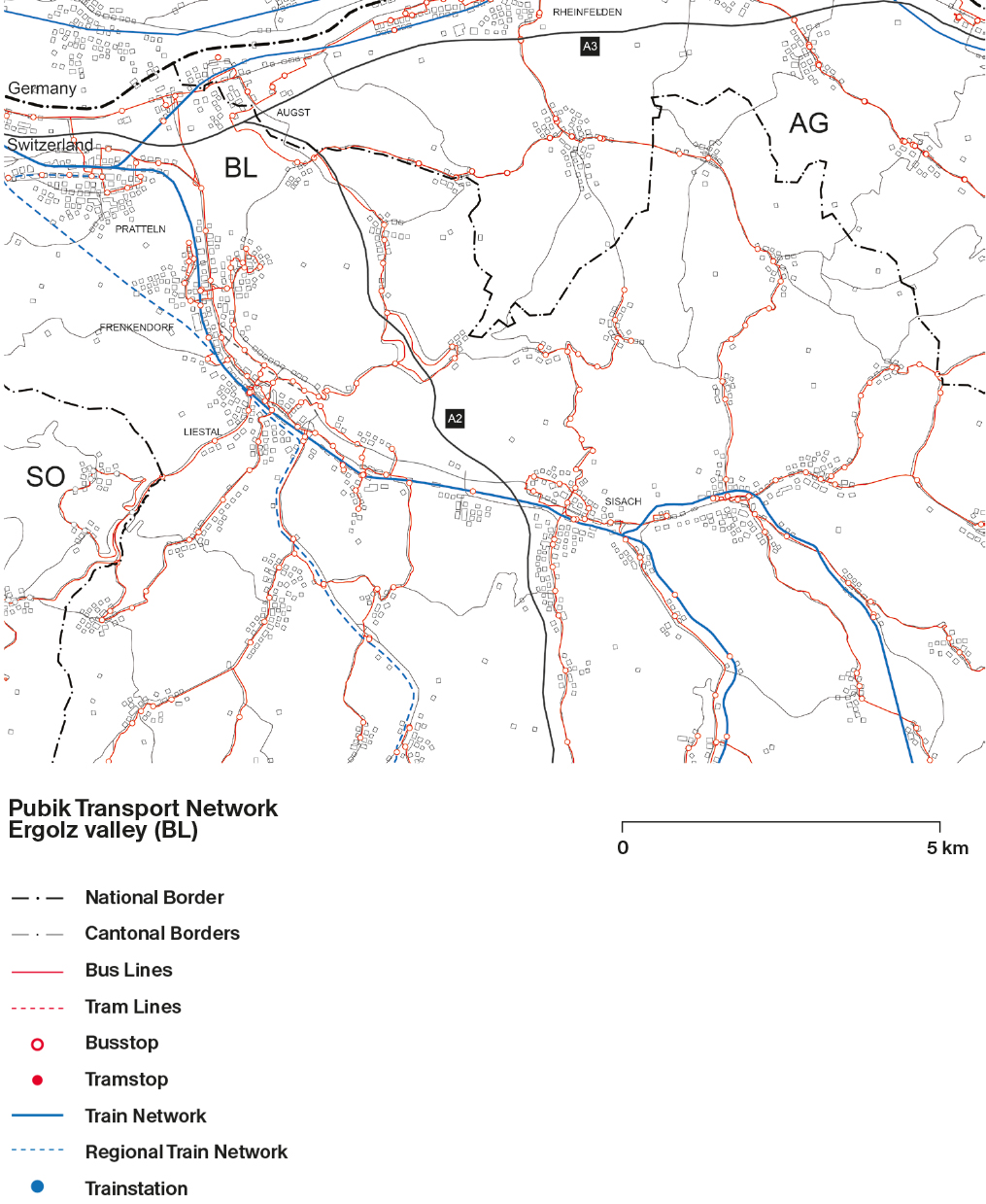
The Ergolztal as it appears today is the result of a long process of urbanization that has been largely influenced and triggered by the construction of the infrastructural lines that cross the region. If until the beginning of the twentieth century the region appears in historical plan as characterized by small-scale settlements distributed along the course of the river, it is with the construction of first the railroad and later the motorways that the region radically changed its conditions. Rather than a constellation of settlements along the valley, the construction of the freeways A2/ A3 in the late 60ies triggered the development of what today appears as an uninterrupted linear city stretching from Frenkendorf to Gelterkinden.
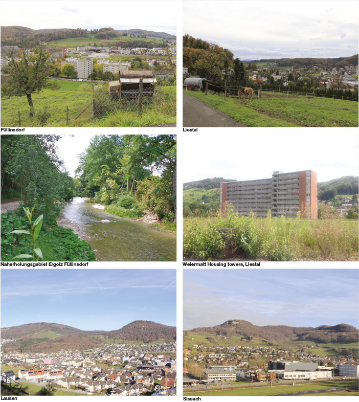
Moving in the region one has the impression to be inside an interrupted sequence of built components of different nature, incoherently placed along the road infrastructure. Patches of recently built single-family houses are interspersed with some small industries and neglected housing neighbourhoods from the 60ies. Within this urban form, historical centers loose their relevance and become a component of this ribbon development. This linear distribution points out to the lack of any attempt to plan the territory as a whole and of coordination and strategic vision among the different communes. The Un-built territory of the hillsides is nonetheless a consistent background of this linear development, to be observed and perceived behind constructions that form the foreground. Only moving outside of the main roads towards the steep slopes on the valleys sides, one finally is able to leave this continuous built system and have the possibility to grasp the geography of the place.


