Wednesday, May 21, 2014
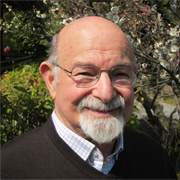
Opening Keynote of Carl Steinitz: “GeoDesign with Little Time and Small Data Post-tsunami Restoration in Soma City, Fukushima Prefecture, Japan”
Abstract:
For serious societal and environmental issues, designing for change is inevitably a collaborative endeavor, with participants from various design professions and geographic sciences, linked by technology from several locations for rapid communication and feedback, and reliant on transparent communication with the people of the place who are also direct participants. The framework within which I organize most of my work and teaching strategies has been published in my recent book A Framework for Geodesign, ESRI Press, 2012. I will present an example application of my framework under conditions of little time and small data.
CV:
Alexander and Victoria Wiley Professor of Landscape Architecture and Planning, Emeritus Harvard Graduate School of Design Carl Steinitz began his affiliation with the Harvard Graduate School of Design as a research associate in the Laboratory for Computer Graphics and Spatial Analysis in 1966. He has held the position of Professor of Landscape Architecture and Planning at the Graduate School of Design since 1973. Professor Steinitz has devoted much of his academic and professional career to improving methods to analyze large land areas and make decisions about conservation and development. His applied research focuses on highly valued landscapes that are undergoing substantial pressures for change. His teaching encompasses such courses as Theories and Methods of Landscape Planning and Visual Landscape Assessment and Management.
In 1984, the Council of Educators in Landscape Architecture (CELA) presented Professor Steinitz with the Outstanding Educator Award for his “extraordinary contribution to environmental design education” and for his “pioneering exploration in the use of computer technology in landscape planning, especially in the areas of resource management and visual impact assessment.” In 1996 he received the annual “Outstanding Practitioner Award” from the International Society of Landscape Ecology (USA). In 2002, he was honored as one of Harvard University’s outstanding teachers.
Professor Steinitz is principal author of “Alternative Futures for Changing Landscapes”, Island Press, 2003, and author of “A Framework for Geodesign”, Esri Press, 2012
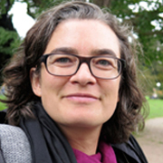
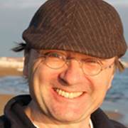
Keynote of Hans-Georg Schwarz-v. Raumer & Antje Stokman: Integrating Technology, Science and Creativity as a Challenge for collaborative Settings in GeoDesign
Abstract:
The current debate on Geodesign methodology is focussing on complex IT-based workflow descriptions that all actors involved in the Geodesign process have to accept and follow as a team. This paper argues that the full potential of the iterative Geodesign circle between geo-data mapping, designing, sketching, GIS-analysis, simulation model runs and spatial representation can only be realized, if we manage to set up a collaborative framework which does not assign the same roles to all participants and which does not fix them to a given technique. The framework must enable people having different skills and viewpoints who usually do not cooperate to work together. The authors discuss the three most crucial fields of differences, interfaces and synergies, which lead to a better methodological and organizational framework of cooperation for the GeoDesign process. Connecting systems and design thinking, individual skills and teamworking, analogous and digital techniques are considered as key challenges, discussed and illustrated with examples from our own geodesign activities.
CV:
Antje Stokman (*1973) is a landscape architect and director of the Institut of Landscape Planning and Ecology at Stuttgart University. After graduation in 2000, she worked on several international projects with Rainer Schmidt Landschaftsarchitekten and has been a member of the German Chamber of Architects since 2004. In 2005, she became an Associate Professor of Ecosystem Design and Watershed Management at Hanover University as well as member of the STUDIO URBANE LANDSCHAFTEN, an interdisciplinary research, practice and teaching platform on the topic of urban landscapes. Since 2010, she co-founded and directs the international Masters Programme “Integrated Urbanism and sustainable Design” at Stuttgart University. Her work focusses on strategies to develop infrastructural and ecological systems as a basis for sustainable urban form and design of urban landscapes. She was awarded the Topos Landscape Award in 2011 and the Lower Saxony Science Prize in 2009. She has been serving as a member of the German national advisory council on spatial planning from 2010-2014 and the sustainability council of the province Baden-Württemberg since 2012.Dr. Hans‐Georg Schwarz‐v.Raumer (*1959) studied Geography and Mathematics at University Karlsruhe, where he had a junior position and got a PhD in Geography. Since 1998 he is senior researcher at Institute of Landscape Planning and Ecology / University of Stuttgart. He is deputy director of the institute and head of the institute’s section “Landscape analysis and modelling”. His scientific fields cover applications of mathematics, modelling and Geographical Information Systems (GIS) in Geography, Ecology and landscape planning. He participated in several projects on land and water resource management where he developed multi-criteria decision support tools and applied scenario techniques, system dynamics as well as spatially explicit land use change modelling. In teaching he is responsible for Ecology, Environmental Studies, Landscape Planning and Geodesign.
Thursday, May 22, 2014
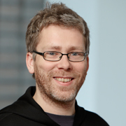
Keynote of Marc Pollefeys: Making it 3D with Limited Resources
Abstract:
While traditionally 3D models of landscapes are being captured using laser scanners or aerial photogrammetry, progress in computer vision over the last two decades has created many new possibilities. In this talk, we will illustrate this with some of our recent work. A mobile phone can be used to interactively capture 3D models of a scene and similarly drones can capture 3D models of their environment autonomously. Landmarks can be reconstructed from online photo-collections and large-scale scenes easily modeled from videos recorded from a vehicle. Also, existing 3D models can be registered using image-based techniques and similarly photographs and videos can be localized to create rich 3D/4D visual representations.
CV:
Marc Pollefeys is a full professor and head of the Institute for Visual Computing of the Dept. of Computer Science of ETH Zurich which he joined in 2007. He leads the Computer Vision and Geometry lab. Previously he was with the Dept. of Computer Science of the University of North Carolina at Chapel Hill where he started as an assistant professor in 2002 and became an associate professor in 2005. Before he was a postdoctoral researcher at the Katholieke Universiteit Leuven in Belgium, where he also received his M.S. and Ph.D. degrees in 1994 and 1999, respectively. His main area of research is computer vision. One of his main research goals is to develop flexible approaches to capture visual representations of real world objects, scenes and events. Dr. Pollefeys has received several prizes for his research, including a Marr prize, an NSF CAREER award, a Packard Fellowship and a ERC Starting Grant. He is the author or co-author of more than 200 peer-reviewed papers. He is the general chair for ECCV 2014 which is to be held in Zurich, was one of the program chairs for the IEEE Conf. on Computer Vision and Pattern Recognition 2009 and was co-chair of the Third Symposium on 3D Data Processing, Visualization and Transmission and has organized workshops and courses at major vision and graphics conferences and has served on the program committees of many conferences. He is a regular reviewer for most of the major vision, graphics and photogrammetry journals. Prof. Pollefeys is/was on the Editorial Board of the IEEE Transactions on Pattern Analysis and Machine Intelligence, the International Journal of Computer Vision, Foundations and Trends in Computer Graphics and Computer Vision and several other journals. He is an IEEE Fellow.
Keynote of Jürgen Döllner: Service-Oriented Geovisualization for GeoDesign
Abstract:
A rapidly growing collection of digital tools, systems, and applications is shaping the way we manage challenges in scientific disciplines and, to a significant degree, defines the scope of possible options and solutions we can develop. In the past few years, a general movement toward distributed, service-based IT solutions can be observed. The software architecture of geovisualization applications and systems demands efficient methods for coping with the conditions and restrictions of mobile devices such as limited networking and computing resources. Service-oriented approaches for scalable, mobile geovisualization applications can be based on a number of key technological concepts. I will address challenges that have to be met along with many technology building blocks recently developed in the field of mobile solutions for virtual 3D city models and landscape models.
CV:
Jürgen Döllner studied mathematics and computer science at the University of Siegen, Germany (1987-1992). He got his Ph.D. in computer science from the University of Münster, Germany, in 1996; he also received here his habilitation degree in 2001. In 2001 he became full professor for computer science (“C4” position) at the Hasso-Plattner-Institute at the University of Potsdam, where he is leading the computer graphics and visualization department. In his department, currently about 14 Ph.D. candidates and PostDocs are employed, complemented by about 20 temporary research assistants. His major research areas represent concepts, tools, and techniques for complex software systems, in particular, graphics-based systems. His research topics include geovisualization (3D real-time rendering, 3D non-photorealistic rendering, geovisualization, virtual 3D city models, and 3D virtual environments) as well as software analysis/visualization (structural visualization, dynamics visualization, evolutionary visualization, software maps, and system/code metrics related to software systems). He is author of more than 200 papers in computer graphics and visualization (for an overview of publications see www.hpi3d.de). He steadily serves as reviewer to a number of international and national journals, conferences, and workshops. Since 2003, he is member of the director’s board of the German association of geoinformatics industry GeoKomm (www.geokomm.de). Apart from his work as university professor, he is also engaged in technology start up companies: He was co-founder of the 3D Geo GmbH, a company specializing in 3D GIS and geovisualization, which developed the LandXplorer software system; the company was completely acquired by Autodesk Inc. in 2008. He is co-founder of Software Diagnostics GmbH, a company specializing in tools for automated software analysis and visualization (www.softwarediagnostics.com). He is co-founder of the 3D Content Logistics GmbH, a software company dedicated to mobile mapping technology (www.3dcontentlogistics.com). As a consultant, he is involved in a large number of technology-driven software projects in the Germany Ministry of Education and Research (BMBF) as well as in companies and startups. He also serves as member of the supervisory board in the Quadfolium Group, a group of companies investing in technology and real-estate enterprises. Web www.hpi3d.de
Friday, May 23, 2014
Keynote of Adrienne Grêt-Regamey & Christophe Girot: Digital methods and collaborative platforms for informing design values with science
Abstract:
While design is increasingly being recognized as common ground to bring scientific knowledge into decision making enacting landscape change, it has mostly been used to create place specific responses expressing particular values until now, rather than framing the natural and physical sciences to become more salient, find legitimation, and consequently have a greater and longer lasting effect on landscape change. Inverting the design approach by first assessing values and then modelling the functionality of the system to infer possible management strategies can better help incorporate scientific knowledge in local place making. I will illustrate such an approach with a case study focusing on rehabilitating the Ciliwung River in Jakarta, Indonesia and show how digital methods in landscape architecture and planning can support an integrative approach, which can help improve design and foster interactive learning of various stakeholder groups.
CV:
Adrienne Grêt-Regamey is Associate Professor at the Chair of Planning Landscape and Urban Systems (PLUS) at the Institute for Spatial and Landscape Development, Department of Civil, Environmental and Geomatics Engineering, since 2008. She was born 1973 in Bern, Switzerland. She studied environmental sciences at ETH. Between 1999 and 2002, Grêt-Regamey worked as a consultant for Stratus Consulting, a company located in Washington, D.C. and Boulder, Colorado, conducting Natural Resource Damage Assessments. In 2003, she won a Marie-Heim Vögtlin stipend from the Swiss National Foundation to conduct her doctoral dissertation at the US National Center of Atmospheric Research in the Environmental and Societal Impact Group, which was followed by a post-doc in the same Institute. In 2006 she was offered a post as a research officer at the Swiss Federal Office for Environment, and returned in 2007 as a senior researcher to ETH. Her research focuses on integrating the goals of sustainable development, economic viability, and good governance in landscape and environmental planning.Christophe Girot is Full Professor at the Chair of Landscape Architecture at the Department of Architecture of the Swiss Federal Institute of Technology in Zurich (ETH). His research addresses three fundamental themes: New topological methods in landscape design, new media in landscape analysis and perception, recent history and theory of landscape design. Emphasis is placed on the fields of action in contemporary large-scale urban landscape with a particular attention given to sustainable design.
Christophe Girot is Professor and Chair of Landscape Architecture at the Architecture Department of the ETH in Zurich. He received a dual Masters in Architecture and Landscape Architecture from UC Berkeley, and was Chair of Design at the Versailles School of Landscape Architecture. His teaching and research interests span new topological methods in landscape design, landscape perception and analysis through new media, and contemporary theory and history of landscape architecture. At the ETH he co-founded the Landscape Visualization and Modeling Laboratory (LVML) with Professor Adrienne Grêt-Regamey in 2010. His professional practice focuses on large-scale landscape projects, using advanced 3D GIS techniques that contribute to the design of more sustainable landscape environments such as the Alptransit Deposit in Sigirino and the Third Rhône River Correction in the Canton of Valais. He currently directs an advanced design research project on the Ciliwung River in Jakarta for the ETH Future Cities Laboratory in Singapore.
Keynote of Clément Willemin: BASE LAND 2050
Abstract:
BASE LAND 2050 is an imagined prospective urban territory model that is used in design at our landscaping and urbanism agency. In 2014 this territory covers a surface of 700 hectares of open, uncultivated land, with streets, esplanades and other areas dedicated to sports, culture, leisure and crop production. Although cars and buildings are generally absent, many other desirable aspects of the city are concentrated in this space which provides an enthusiastic perspective on a possible future for urban space. This territory may be a piece of virtuality, as it does not exist yet. This may be a virtual space, as it does not exist yet, but it is also a digital landscape responding to nothing more than the tips of our fingers.
BASE LAND 2050 is an imagined prospective urban territory model that is used in design at our landscaping and urbanism agency. In 2014 this territory covers a surface of 700 hectares of open, uncultivated land, with streets, esplanades and other areas dedicated to sports, culture, leisure and crop production. Although cars and buildings are generally absent, many other desirable aspects of the city are concentrated in this space which provides an enthusiastic perspective on a possible future for urban space. This territory may be a piece of virtuality, as it does not exist yet. This may be a virtual space, as it does not exist yet, but it is also a digital landscape responding to nothing more than the tips of our fingers.
Closing Keynote of Erich Buhmann: Future Collaborative Activities to Meet the Challenges of GeoDesign
CV:
Prof. Erich Buhmann holds a bachelor degree in Landscape Architecture from Munich-Weihenstephan and a MLA as Fulbright Scholar from SUNY Syracuse in the United States. He was appointed professor at Anhalt University of Applied Sciences in 1995 for “Landschaftsinformatik” and served as founding director of the English language Master of Landscape Architecture (MLA) program form 1998-2008. As a registered landscape architect, he is a partner in the landscape architecture firm ATELIER BERNBURG Landschaftsarchitekten. He is manager of the regional chapter of the German Society of Landscape Architects BDLA in the State of Saxony Anhalt in Germany. From 1995 to 2008, he co-authored the annual GIS Report for the German speaking part of Europe. He is a member of the ECLAS and LE:NOTRE Steering Committee, Chair of the ECLAS Committee Digital Technology and Chair of the ECLAS Committee Accreditation System. Buhmann has been Chair of the annual conference Digital Landscape Architecture since 1999.
Prof. Erich Buhmann holds a bachelor degree in Landscape Architecture from Munich-Weihenstephan and a MLA as Fulbright Scholar from SUNY Syracuse in the United States. He was appointed professor at Anhalt University of Applied Sciences in 1995 for “Landschaftsinformatik” and served as founding director of the English language Master of Landscape Architecture (MLA) program form 1998-2008. As a registered landscape architect, he is a partner in the landscape architecture firm ATELIER BERNBURG Landschaftsarchitekten. He is manager of the regional chapter of the German Society of Landscape Architects BDLA in the State of Saxony Anhalt in Germany. From 1995 to 2008, he co-authored the annual GIS Report for the German speaking part of Europe. He is a member of the ECLAS and LE:NOTRE Steering Committee, Chair of the ECLAS Committee Digital Technology and Chair of the ECLAS Committee Accreditation System. Buhmann has been Chair of the annual conference Digital Landscape Architecture since 1999.

