In the three days of the DLA Conference, i.e., 21,22 and 23 May 2014, there will be 5 workshops on specialized topics in Digital Landscape Architecture/Planning Design, digital toolmaking for GeoDesign in parallel to the ongoing sessions. These workshops have proven to provide a lively forum in previous conferences.
Participation is free and only available for registered participants of the DLA conference.
General Contact
Please feel free to contact Pia Fricker (dla2014@ethz.ch) if you have general questions regarding the workshops, which cannot be answered through the particular workshop organizers.
Registration
Workshop registration has to be done within the general registration: http://dla.loel.hs-anhalt.de/dla2014/registration/ or via email to: dla2014@ethz.ch
Overview:
Workshop 1: Site Building: From UAV Data to Landscape Transformation (parallel 3 hours workshop)
Workshop 2: Lands Design: landscaping tools for Rhino (parallel 3 hours workshop)
Workshop 3: Autodesk InfraWorks: Conceptual design in large scale 3D urban and landscape models (parallel 3 hours workshop)
Workshop 4: Development of New Methods for Geo Design using Arc GIS CityEngine and 3DLibraries (parallel 3 hours workshop)
Workshop 5: CINEMA 4D Workshop on 3D Plants and Landscape Visualization (parallel 3 hours workshop)
Content:
Workshop 1: Site Building: From UAV Data to Landscape Transformation
Instructor: James Melsom, Luis E.Fraguada
Contact email for questions: melsom@arch.ethz.ch
Affiliation: ETH Zurich, Professor Christophe Girot, Chair of Landscape Architecture
Date and Time: Thursday, May 22, 2014 from 09.45am – 1.00pm
Room: LVML, HIL H
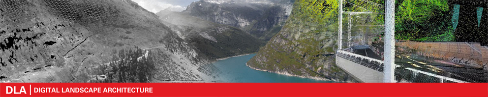
Since its inception in 2009, the LVML has been developing methods of site scanning and modelling of the landscape. A key aspect of this research is the use of UAV technologies to empower the discipline with the ability to capture complexity of landscape sites. The inclusion of photogrammetry in the practice of landscape architecture opens entirely new possibilities for interdisciplinary collaboration, and allows insight into remote or un-mapped sites.
This session gives an overview of the various possibilities and applications of UAV technology, including the considerations for working in various sites and conditions worldwide. The session will include an example flight and dataset collection site-visit*. The participants will be given insights into various past scan campaigns, and have the opportunity to interface the resulting data with other various data sources.
(*Assuming appropriate meteorological conditions)
Workshop 2: Lands Design: landscaping tools for Rhino
Instructor: Francesc Salla, Architect and VisualARQ Product Manager
Contact email for questions: fsalla@asuni.com
Affiliation: Architectural tools for Rhinoceros, www.visualarq.com
Date and Time: Friday, May 23, 2014 from 09.45am – 1.00pm
Room:to be announced
Lands Design is a software for designing gardens, green spaces, and landscapes that runs in the Rhino environment. The workshop will cover the following topics:
- Work with plant species: insert trees, shrubs, parterres, and arrange them in rows, forests, etc…
- Plant data base: Edit, customize and create new plant species.
- Civil work: create object rows, fences, paths, hedges, etc…
- Terrain modeling: create terrains from contours, curves, point clouds or imported from Google Earth. Tools to edit terrains: apply cut and fills, hollows, insert paths, etc..
- Generate setting out plans and project information: 2D plans and lists to quantify species and the project information.
- Rendering tips.
Workshop 3: Autodesk InfraWorks: Conceptual design in large scale 3D urban and landscape models
Instructor: Markus Briglmeir, Product Manager Autodesk InfraWorks
Contact email for questions: Markus.briglmeir@autodesk.com
Affiliation: Autodesk, Central Europe http://www.autodesk.com/
Date and Time: Friday, May 23, 2014 from 09.45am – 1.00pm
Room: to be announced
The Autodesk® InfraWorks™ 3D city model software can help you create, analyze, and visualize digital city and infrastructure models. It allows stakeholders from the public, city government, construction, and business communities to work together and visualize infrastructure projects before they’re built. Being able to experience the future of a city before it’s real enables all involved to understand how policy and proposals can impact the urban environment.
Imagine being able to experience real-world city scenarios and share them with citizens and stakeholders before construction. Whether you need to create small- or large-scale models of city and infrastructure projects, Autodesk InfraWorks can provide you with the realistic preliminary design and visualization tools you need to make informed design decisions throughout the urban design lifecycle.
In this Hands On Session attendees get an overview of Autodesk InfraWorks by creating their own city and infrastructure model and adding different conceptual design alternatives of a ‘new city or infrastructure project’.
Prerequisites: Basic knowledge of GIS & CAD data and 3D models. No Autodesk InfraWorks knowledge necessary.
Technical requirements:
Hands On Session Participants are required to bring their own laptops. The software Autodesk InfraWorks needs to be installed before the workshop starts. Autodesk Software can be downloaded from http://www.autodesk.com/edcommunity for “hands-on” lessons. Please check system requirements.
Workshop 4: Development of New Methods for Geo Design using Arc GIS CityEngine and 3D Libraries
Instructor: Christian Sailer
Contact email for questions: c.sailer@esri.ch
Affiliation: Esri Schweiz AG: http://www.esri.ch/, Ersi Inc. and SmarterBetterCities
Date and Time: Thursday, May 22, 2014 from 2.45pm to 5.45pm
Room:to be announced
ArcGIS helps you use spatial information to perform deep analysis, gain a greater understanding of your data, and make more informed decisions. It’s a platform for: GIS Professionals, Location Analytics, Developers.
Esri CityEngine create amazing 3D cities quickly and easily by transforming 2D GIS data into smart 3D city models. It enables the rapid creation of 3D models through a suite of industry-leading procedural tools. The Esri solution improves urban planning, architecture and design. Use its 3D visualization power to see the relationships of projects, assess their feasibility, and plan their implementation and helps you make quality decisions that benefit your community for decades.
Share your city models in 3D with the CloudCities Viewer of Smarterbettercities. The product offers an intuitive web interface for tablets, smartphones and desktop computers. Use the power of its 3D Cities Libraries for transect-oriented planning and development and form-based code designs and evaluate your projects by its apps for ArcGIS CityEngine and ArcGIS Desktop.
This session gets a quick overview of the arcgis platform and shows the online warehouse of maps, data, applications and. We explore the basic methods of CityEngine; CGA, the scripting language that drives procedural generation of features; and the types of data necessary to build 3D scenes. We show a custom 3D Library for CityEngine and finalize the session with the kind of quick and customized sharing of 3D scenes over the web for collaboration.
Prerequisites:
Basic knowledge of GIS.
Technical requirements:
Participants are required to bring their own mobile device and and laptops.
Workshop 5: CINEMA 4D Workshop on 3D Plants and Landscape Visualization
Instructor: Philip Paar
Contact email for questions: philip.paar@laubwerk.com
Affiliation: laubwerk: http://www.laubwerk.com/
Date and Time: Wednesday, May 21, 2014 from 2.459m – 5.45pm
Room: LVML, HIL H
Dealing with virtual foliage in 3D applications is still complicated, time-consuming, often painfully slow and usually the final plants still don’t look computer generated. Especially in digital landscape architecture practice, photomontage still seems to be the first choice when it comes to the representation of vegetation.
We present a new approach for landscape architects and CG artists looking for a fluent way to insert authentic-looking, highly-detailed 3D vegetation into their 3D scenes and CG artwork. This instructor-led mainly “hands-on” workshop is based on one of the easiest to use professional 3D software programs called CINEMA 4D (www.maxon.net). Furthermore, tools such as MoGraph as well as the plug-ins Laubwerk Plants, and the SurfaceSPREAD are introduced and applied. SurfaceSPREAD is specifically designed to distribute large amounts of object clones onto landscape scenes in a way that is reactive to the landscape’s topography. Learn a new and easy way of adding trees to your renderings and to quickly adjust the Plants according to the shape, age, season and level of detail the scene requires. Target groups of the workshop are landscape architects, students, researchers and practitioners interested in 3D modeling and visualization of gardens, landscapes, and architecture.
Prerequisites:
Basic knowledge of 3D modeling or CAD software
Technical requirements:
Hands-on session participants use the PCs with the necessary software in the ETHZ LVML lab. The free demo or student version of MAXON CINEMA 4D can be downloaded from http://www.maxon.net. The free Laubwerk Plants Kit Freebie for CINEMA 4D or Autodesk 3ds Max can be downloaded here http://www.laubwerk.com/store/plants-kit-freebie/