Olten Region

Site introduction
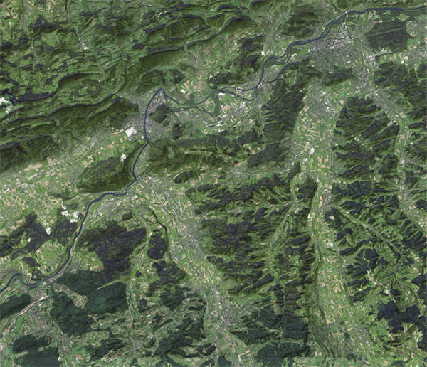
The project site Olten region can be loosely defined as a vast rectangular shape area stretching between the city of Aarau to the east, the city of Oensingen to the west, the Jura Mountains to the north and the city of Zofingen to the south. At the center of this region lies the city of Olten. Our interest was not on a location but rather on the urban condition that we believe is at best observable in this territorial section of the Mittelland which is representative of the rapid urbanization and industrialization processes that took place in the last century and that continue to transform a territory world famous for its landscape and natural resources.
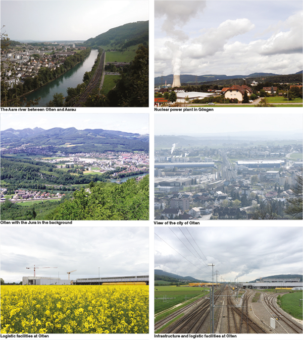
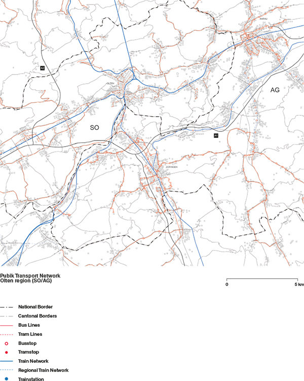
As the settlement area in Switzerland is doubled since 1950, the landscape of the Mittelland is strongly affected by urban sprawl and rising urbanization. The choice of focusing on this specific section of the river Aare valley, centred around the city of Olten is motivated by the geographical position of Olten itself. Olten is literally at the centre of the country, at the crossroad of the north-south/east-west railway and motorway corridors stretching between St.Gallen and Geneve and between Basel and Chiasso. Because of its location, its railway station stands within 30 minutes from Zurich, Bern, Basel and Lucerne and represents a crucial rail hub for the entire country. Due to its strategic location and efficient infrastructural network, the city has grown over the years as the national logistical hub, becoming the seat of many industries and service companies distributed primarily along the A1 motorway. In the larger territory of the Aare and of the Wigger valleys, settlements have grown in a rather disordered and incoherent way following the course of the rivers, and later primarily of motorway and railway infrastructures.
The region of Olten as it appears today is the result of a long process of urbanization that has been largely influenced and triggered by the construction of the infrastructural lines that cross the region. If until the beginning of the twentieth century the region appears in historical plans as characterized by small-scale settlements distributed along the course of the rivers, it is with the construction of the motorways that the region radically changed its conditions. Rather than a constellation of settlements around the Born Mountain, the motorways infrastructure triggered the development of what today appears as an uninterrupted linear city stretching along the A1/A2 and the national road connecting Egerkingen to Aarau. Following the construction of the motorways during the 70s, large logistic and distribution companies located their storage and distribution facilities in the region of Olten. This process was triggered by the possibility to easily and quickly access to the national motorway system. Yet, despite the territorial growth and economic success of the region, the city of Olten has not witnessed any significant demographic growth, as many prefer to settle in small villages surrounding the city. Olten has also so far failed to attract commuters from other cities (e.g. Zurich) despite its good level of connectivity and accessibility.
Moving through the region one has the impression to be inside an interrupted sequence of built components of different nature, incoherently placed along the road infrastructure. Patches of recently built single-family houses are interspersed with small industries, shopping facilities and large distribution centers. This linear distribution points out to the lack of any attempt to plan the territory, of coordination and strategic vision among the different communes. By crossing along the main roads, the un-built territory is nonetheless a consistent background of this linear development, to be observed and perceived behind constructions that constitute a generic foreground. Only moving outside of the main roads towards the slopes on the valley’s sides, one finally is able to leave this continuous built system and have the possibility to grasp the geography of the place.


