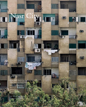
Nasr City

Students: Marc Frochaux, Aurel Martin
Location: Cairo
Date: October, 2010
Type: Research project, student work
The 1956 Master Plan for Cairo recommended the chanelling of the tremendous demographic growth at the time into relatively self-contained satellite communities that are located in the desert rather than in the fertile margins of the existing city. The planning of Nasr City in 1958 by Mahmud Riad, the architect for Mohandessin and former chief of the Cairo baladiya—municipality—also involved the founder of al-’Imara (Architecture), the first architectural magazine in Arabic, Sayyid Karim, an ardent proponent of modernism in architecture and was built jointly by the Ministry of Housing and the Ministry of Defense. Selected because it was in the barracks of the zone that the Revolution of 1952 (whose secret watchword was nasr, meaning “victory”) was conceived and planned, the site lies between the outermost edge of Abbasiyah and Heliopolis. Designed to house the Nasserist technocrats but also was the preferred site for the state’s planning organs, the Ministry and National Institute of Planning, and Central Agency for Public Mobilisation and Statitistics, Nasr City embodied the regime’s concept of Cairo as a technocratic planning nucleus, with zones of use for 1) administrative-institutional, 2) industrial, recreational and educational and 3) residential use.
This topic will look at the contemporary manifestations of the socialist ideals of the revolutionary state and the ensuing liberalization policies of Egypt’s Intifah which liquidated the centrally planned development. As is in Mohandessin, the influx of Gulf capital and returning Egyptians who had worked in the Gulf—nafti, literally meaning oil—have also created here the requisite mall and high end hotels (ie the City Stars developed by Saudi developers) which nevertheless are in close proximity to military institutions and housing from which Nasr City started.
Download the Book PDF

