Western Hochrheintal
Site introduction
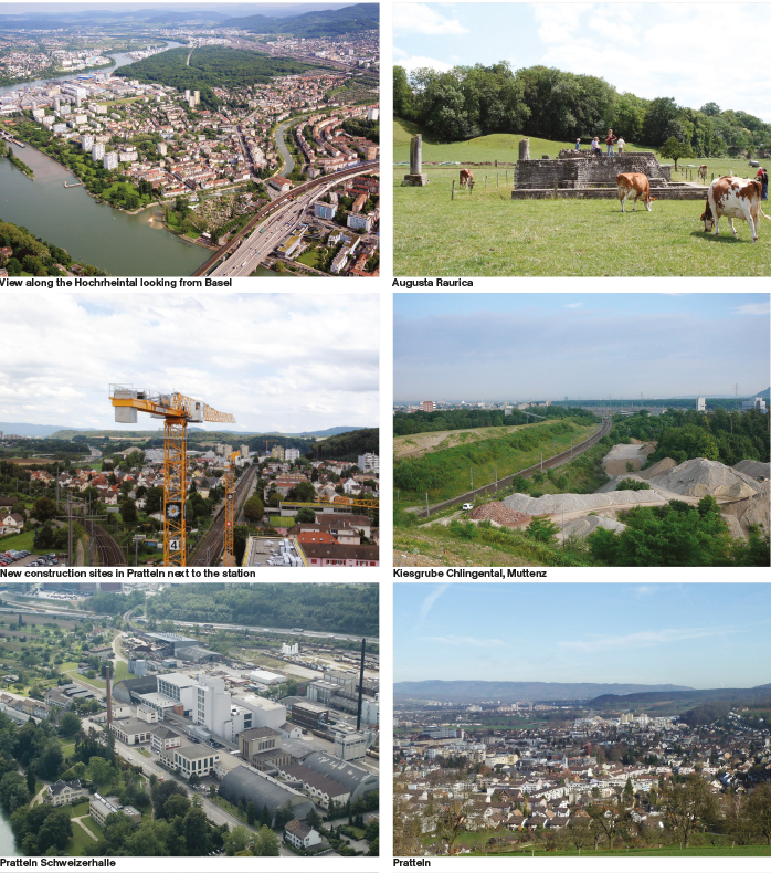
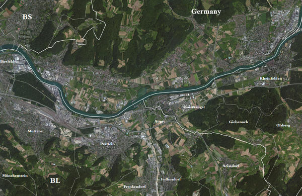
The western Hochrhein Valley (High-Rhine-Valley), between Rheinfelden and Muttenz, is the last section of the Hochrhein Valley that marks to a large extent the border between Switzerland and Germany, from the Bodensee to the Rheinknie (northwards bend of the Rhine) in Basel, where the Rhine flows into the Oberrheinische Tiefebene (Upper-Rhine Plain). The area hosts, today, 62’014 residents (Birsfelden 10’285, Muttenz 17’507, Pratteln 15’496, Augst 837, Kaiseraugst 5’507, Rheinfelden 12’382 ). The total surface of the area is 95,8 km2. 30,77% of it, is covered by settlements or urban areas. The main economic factor is the Tertiary sector.
The western Hochrhein Valley is composed by two very distinct geological formations: the Dinkelberg on the German side in the north, and the foothills of the younger Tafel-Jura with the Gempenplateau and the Olsbergerwald in the south of Swiss territory. The western boarder of this landscape entity, the bottleneck at the Hornfelsen (Hörnli) in the east of Basel, is a strong landmark. The bottom of the valley was filled up with gravel brought along by the Rhine at the End of the last Ice-Age 30’000-12’000 years ago. Today these vast and flat areas form the fertile higher and lower terraces of the river valley. The area has a long settlement history. After smaller Celtic settlements in the early first millennium B.C., romans founded Augusta Raurica (today next to Augst/ Kaiseraugst) in the first century B.C with a bridge crossing the Rhine at Augst. Already at that time the important trade routes along the valley where decisive for the formation of the settlements in the area. One particular characteristic of the western Hochrhein Valley is the layer of salt about 150m below ground that has been an important resource in the rapid industrial development of the area. Another crucial factor has been the Rhine itself. The hydroelectric power plant at Rheinfelden (1898) was the biggest in Europe at its time and today the plants in Rheinfelden, Augst-Wyhlen and Birsfelden are still important for the regions’ energy supply. The current morphology and location of the once meandering riverbed is strongly influenced by the power plants and their barrages. The establishment of the dye and silk industry along the river in early industrialization times was the start of the regions development towards the life-science-site of international importance that it is today. In the western Hochrhein Valley the chemical industry is located on both sites of the Rhein. Another large-scale program at the riverbanks are the extensive infrastructural areas of the two Swiss Ports in Baselland (Hafen Birsfelden, Auhafen Muttenz build in the 1930’s) part of the most important import and export hubs of Switzerland.
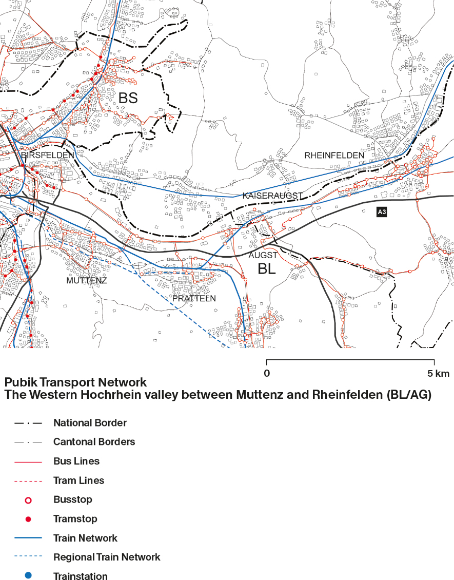
Extensive railway infrastructure (see Marshalling yard Basel I, Muttenzerfeld), logistic centers (e.g. Coop national distribution center in Pratteln) and the infrastructural corridors of the Highways are reasons for the fragmented state of the agglomeration in the Hochrhein Valley. The Rhine can be hardly accessed or perceived. Movement perpendicular to the river is relatively difficult and the connections to the German site of the Rhine are rare. The settlements grew with the economic success of the region from small farming villages to large industrial settlements filling the valley wherever there was availability of space. Today single-family settlement areas are sprawling up to the forested hills of the Tafeljura and the western Hochrhein Valley . With significantly lower taxes than Basel-Stadt, the canton of Basel-land is an attractive area for housing neighbourhoods. The limited building-zone reserves force the communities to think about new sites and housing typologies.