
The Armenian Quarters in Beirut
Bourj Hammoud and Karm El Zeitoun
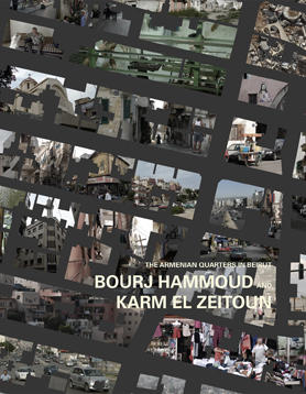
Students: Daniel Hediger, Andrej Lukic
Location: Beirut
Date: October, 2009
Type: Research project, student work
Background
The Armenian Genocide unfolded during the last years of the ailing Ottoman Empire, beginning on April 24th, 1915 and continuing until the end of World War I. An estimated 1 to 1.5 million Armenians were killed by the Ottomans. It resulted in huge waves of refugees, trying to flee from slaughter and settling in different places all over the Middle East, many of them coming to Lebanon.
Themes
Bourj Hammoud was founded by survivors of the Armenian Genocide of 1915 and expanded mostly during the 1930s. When the Armenians who had survived the genocide arrived in Beirut after the collapse of the Ottoman Empire, they were given the right to construct shacks in the east of the city, what was then only a swamp. These shacks were later converted into permanent constructions out of which today’s neighborhood developed. The plan that was used to construct the refugee camp for the initial settlement still forms the imprint of the community today: It is a standard solution for refugee camps, a perfect, dense grid of approximately 25 x 75 M. What was originally thought of as a layout for a temporary settlement has morphed into a solidified, permanent, three-dimensional grid of housing, working, trading and learning. In fact, Bourj Hammoud with today approximately 150.000 inhabitants on an area of 2.5km2 has been described one of the densest settlements in the Middle East. Within the urban fabric of Beirut, a city very much influenced by its topography and with its street layout often corresponding to contour lines, the perfect grid arrangement visibly stands out and forms a separate entity on its own. Close to Bourj Hammoud, the grid-like camp-become-city, a similar but strikingly different neighborhood is located: Karm El Zeitoun. Located to the west just across the Beirut river, it also features a gridded street layout, but this time located on a highly accentuated topographical terrain. Developed at the same time as Bourj Hammoud by an Armenian investor who wanted to bring quality of life to his fellow countrymen, offering minimum standard services and a favorable topographic setting, which has since developed into something akin of a hill-town.
Project
What is the urban idea of the ‘Armenian City’? How does the “neutrality” of the grid influence the use of the different parts of the neighborhood? It’s value? Can we identify a ‘Manhattan-phenomena’ where the unit system offers ideal conditions for variations of urban typologies and an appropriation by diverse social groups? How does politics play out in the urban fabric of Bourj Hammoud? What is its relationship to its ‘urban sibling’ of Karm el Zeitoun?
Download the Book PDF